Geological survey of the Upper Rhine Graben Airborne Geophysical Survey
New data for the energy transition.
Starting in mid-November, Vulcan Energy will conduct large-scale aerial surveying in the central and northern Upper Rhine Graben. The aim is to gain a better understanding of the geological subsurface and improve the planning of future geothermal projects.
The survey will measure the Earth’s natural gravitational and magnetic fields. This data will help analyze the rock layers beneath the Earth’s surface. This makes it possible, for example, to distinguish how permeable the rocks are or where certain types of rock, such as volcanic rock, are located. This is important for finding out where geothermal energy can be used particularly effectively.
The measurement methods used are completely passive – they do not emit any radiation and are completely harmless to humans, animals, and the environment.

Frequently Asked Questions for the Community Questions & Answers.
Chances are that you’re on this page because you have been notified that a plane is surveying your area and maybe you have some questions. We hope the information provided is useful. If you cannot find what you are looking for, we welcome you to reach us at seismik@v-er.eu.
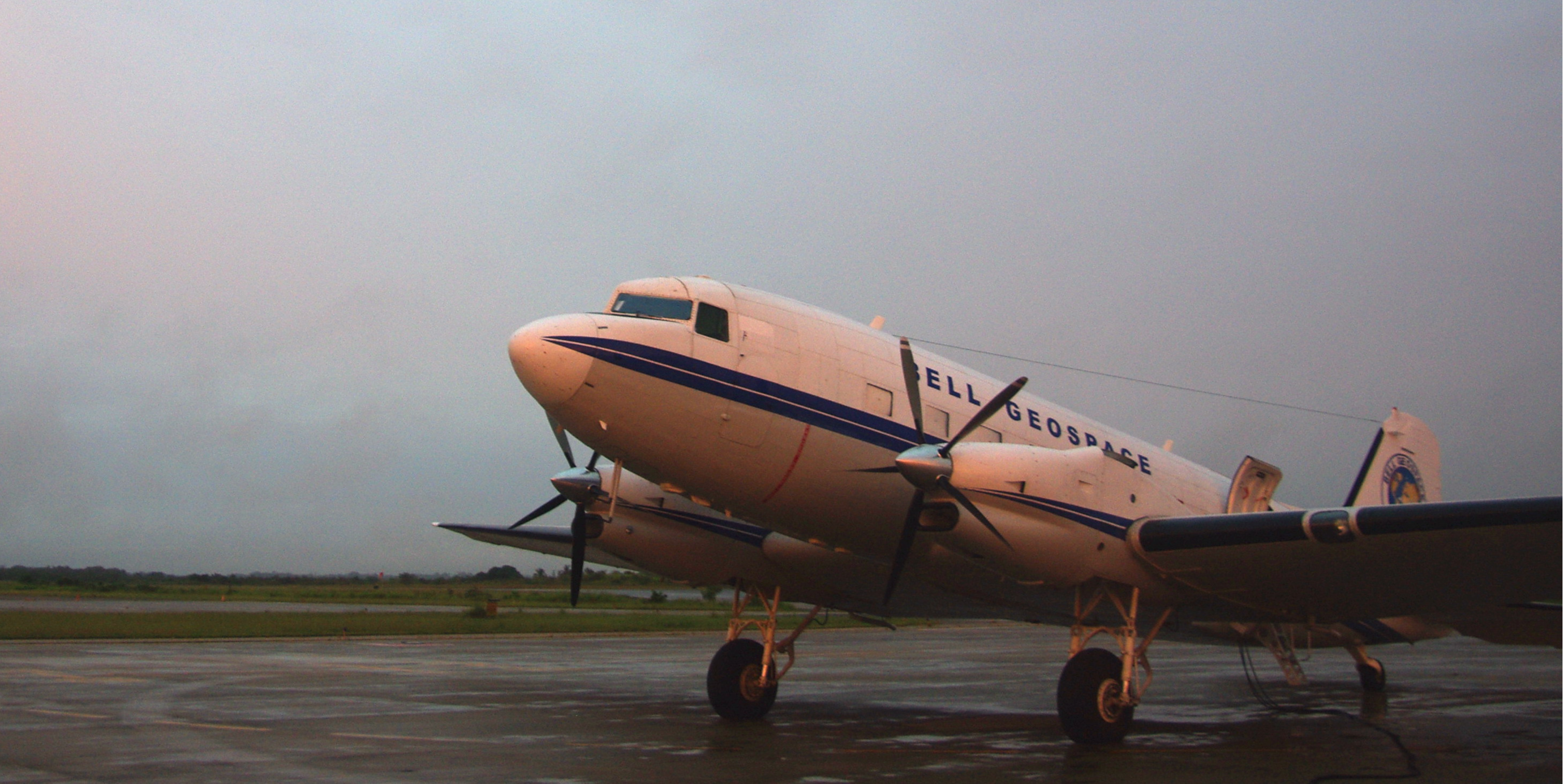
The survey will be managed and flown by Bell Geospace.
Bell Geospace are a UK-based company with an office in Edinburgh, Scotland. Bell Geospace owns and operates three aircraft which have been especially modified for geological mapping. The company has over twenty-five years experience in geophysical surveys and a wide variety of experience across many countries and conditions. There will be one aircraft (a Basler BT67) operating on the survey.
The purpose of the survey is to collect geophysical information on the properties of the rocks below the ground.
By carrying special technology onboard, the Bell Geospace aircraft is able to sense and measure geological properties which cannot otherwise be seen. Essentially, we are able ‘see’ through to the Earth’s subsurface.
The survey in Cornwall is collecting information to make geological maps. These maps may be used for evaluating the geothermal energy and lithium potential in the Cornwall area. Lithium is considered a critical mineral, needed to meet net-zero economic goals.
The information collected will be used as a part of a wider consideration on future steps for activities in the area. Data acquisition does not represent any excavation activity. Bell Geospace is not a mining company.
Flights will take place daily, each morning.
Flights take place during daylight and tend to take place in the morning.
Usually flights will start from 8:30am or just after sunrise. We expect to be flying for up to five hours per day.
Flights may continue on weekends and public holidays.
Inclement weather (excessive wind, storms, clouds) can cause flight delays, as can unforeseen circumstances such as unannounced military practice or unexpected wild animal/ bird activity.
The survey is safe and is an entirely passive process.
Neither the technology on the aircraft, nor the aircraft send out any signals or booms into the Earth.
Information is collected by measuring gravity and derivates of gravity (which is known as gradiometry). It is an entirely passive process.
The survey area.
The flight can be tracked on FlightRadar24.

The aircraft.
The Basler BT-67 is an ideal plane for this job.
Bell Geospace required a plane with two engines for added safety, low sensitivity to turbulence for improved data quality, a strong track record of reliability, and good endurance for increased international reach. The Basler BT-67 met these requirements. The BT-67 is a converted DC-3 aircraft fitted with twin turboprop engines and state-of-the-art digital avionics. It combines excellent productivity with logistical efficiency.